


If you were traveling to Duluth from St. Paul in 1870, only one railroad could get you there: the Lake Superior and Mississippi Railroad (LSMR), commonly known as the “Skally Line.”
When you arrived at the wilderness outpost of Thomson (20 miles south of Duluth), the train crossed a roaring gorge, where the St. Louis River tumbles down the granite walls. In 1870, this place was known as “the Dalles.” Today, it is the site of a large hydropower dam, easily viewable from Highway 210. The Munger Trail now crosses the river on a bridge in the same location.
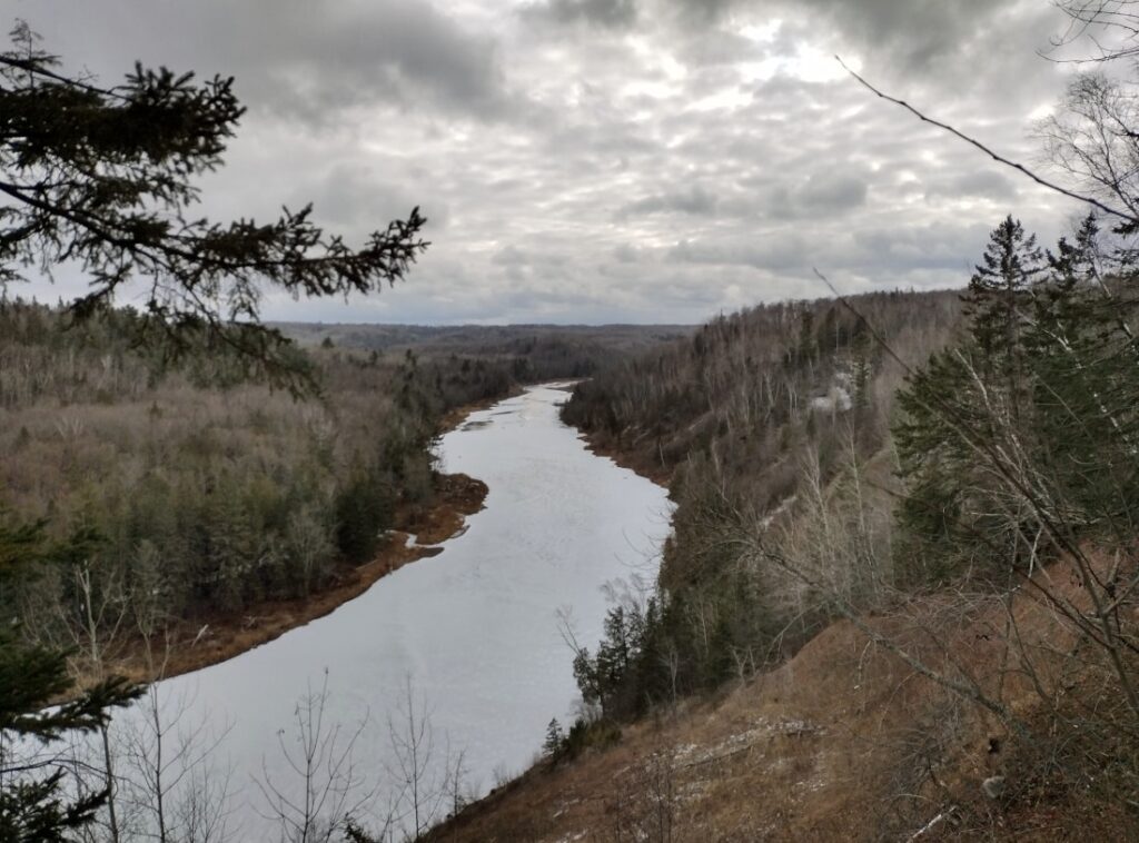
Leaving the Dalles, the Skally Line curved and began to follow the St. Louis River downstream, where scenic views of the wild country surrounded the passengers. Bit by bit, the cars picked up speed.
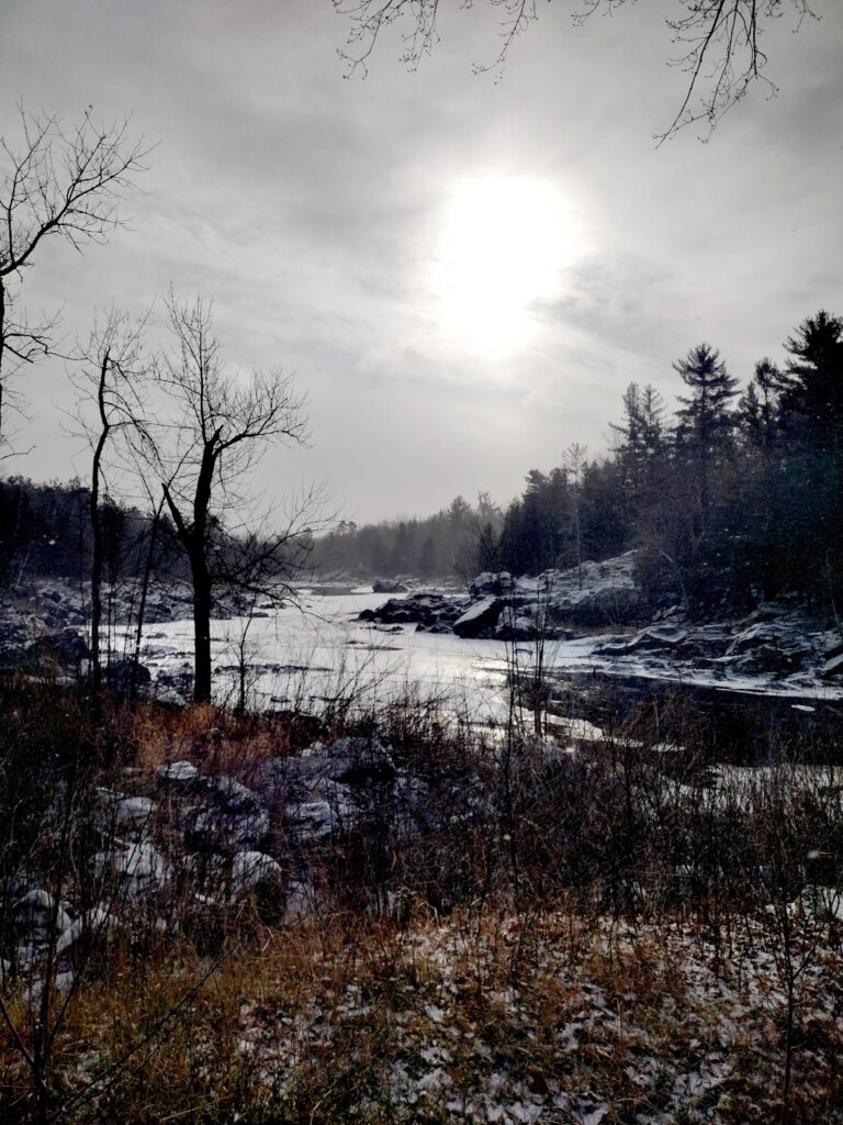
Two miles down the track, the train shot out of the trees and over a wooden trestle spanning a massive clay-banked gorge. Centrifugal force caused passengers to lean to the side as the train rounded Oldenburg Point and sailed out over another expansive ravine.
Faster and faster the train went, flying over more gorges and trestles. In 1870, before the invention of air brakes, railroad employees would have had to manually apply crude brakes to each car individually. They did this by running along the roofs of the cars, turning hand-cranks to apply the brakes and occasionally getting thrown off the train in the process. The newspapers of the time reported brakeman fatalities regularly.
After six miles of this harrowing ride, the train flew around the corner into Fond du Lac, brakes smoking, and rocked to a halt in front of the Fond du Lac depot, where the passengers had a chance to refresh themselves and the brakemen were able to unclench their hands from their controls.
The train then traveled on a level grade through the St. Louis River estuary for the remaining 15 miles to Duluth.
The six miles of track between Thomson and Fond du Lac had problems from the beginning. Mudslides and washouts were common, and sparks from the train had a tendency to set the trestles afire.
When a new railroad was built into Duluth via a different route, much of the Skally Line’s traffic shifted to the new line. When another trestle burned in 1894, most of the Skally Line between Thomson and Fond du Lac closed for good. A portion of the line remained open between Fond du Lac and the tiny town of Forbay until the 1940s.
It’s still there
Since 2017, I have been exploring the six miles of the Skally Line between Thomson and Fond du Lac. The section which closed in 1894 is located within Jay Cooke State Park. The vast majority of the public remains unaware that Duluth’s first railroad is there. The park calls no attention to this, despite the fact that the park is named after the railroad’s original owner, financier Jay Cooke.
Much of the line has been replaced or repurposed for other uses. Highway 210, Jay Cooke’s main road, follows the route of the Skally Line in many places. Ski trails and bike trails also make use of the railroad grade, which provides rare level ground in a landscape of steep slopes.
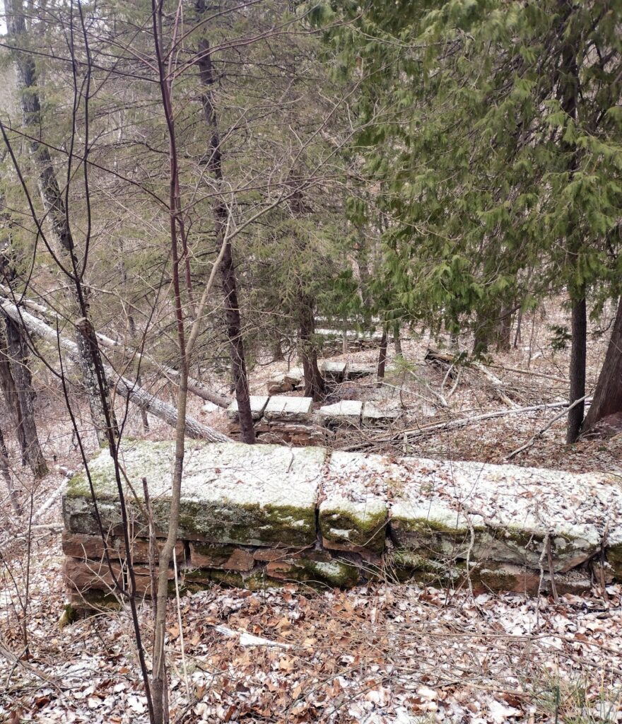
There are also areas where the railroad grade is not being used for anything currently. More than a century of washouts and mudslides have destroyed portions of it. However, much of it still remains—perfectly recognizable railroad grade in the wilderness.
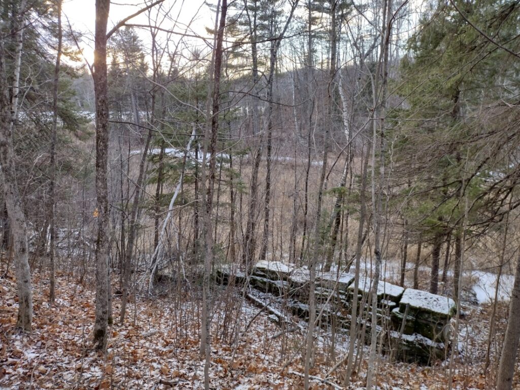
A wealth of artifacts may be found along the route—trestle footings, retaining walls, bolts, cables, timbers, ties, random junk, and so on. Some features are easily accessible; others require more effort.
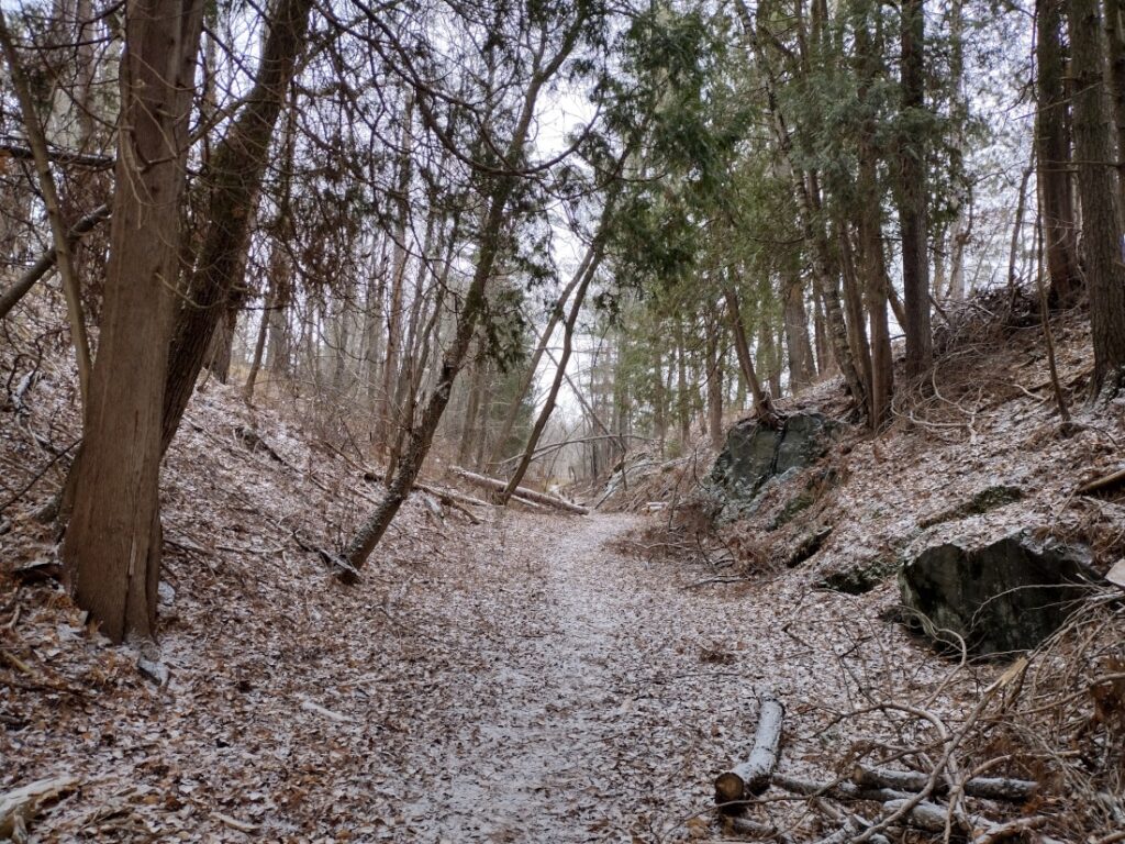
Thomson grade cut
Following the Skally Line grade, the Thomson Trail crosses Highway 210, near the border which separates Thomson and Jay Cooke Park. This is most noticeable a short distance off the highway, where the grade cuts through a hill. Despite the forest having grown in, it is easy to see that the slopes on either side of the trail are engineered.
When Highway 210 was built, it went around the grade cut, leaving a short section of the Skally Line intact for history buffs to admire.
Trestle footings
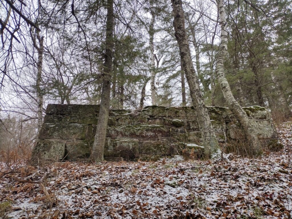
During my most recent walk, on Nov. 26, I counted 50 trestle footings in 5 different ravines. Even when the footings are close to Highway 210, they are overgrown and not highly visible from the road.
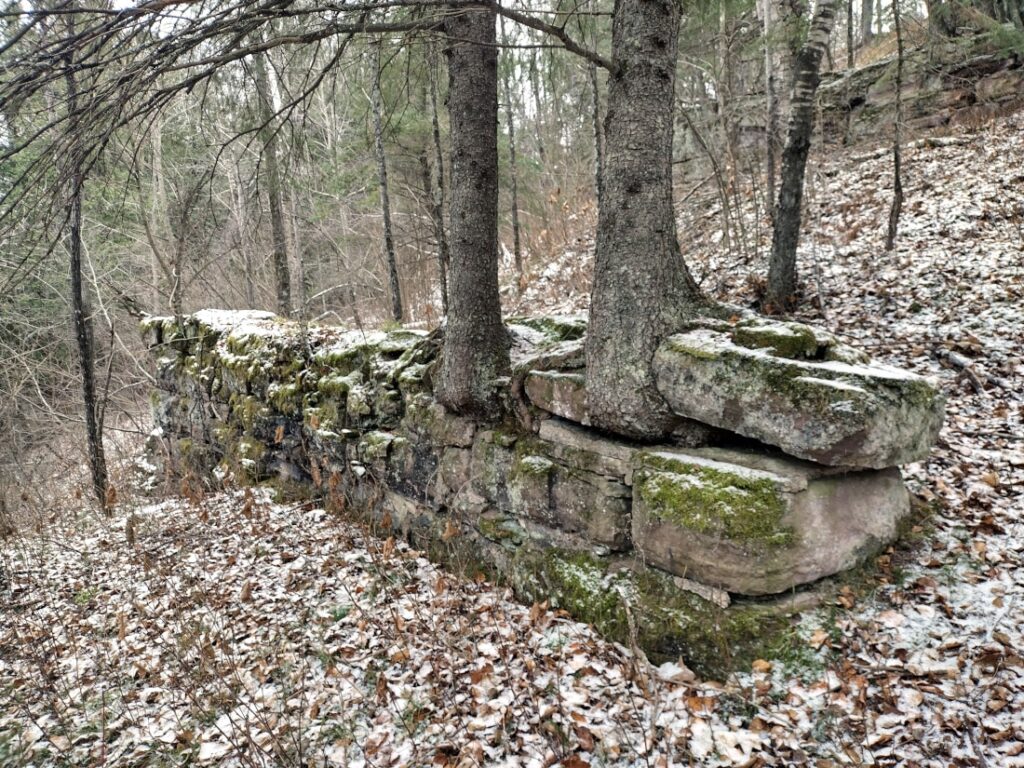
The 153-year-old footings are constructed of sandstone blocks. Many have trees growing atop them, with roots snaking in and around the blocks. The largest footings, at the bottom of the deepest ravine, are 40 feet long and 8 feet high (unofficial Monitor’s estimate).
Clambering in and out of the ravines of Jay Cooke is a chore if the ground is wet and muddy, as it is during spring snowmelt or after rain events. The best time to explore is in November, after the ground has frozen but before the snow flies.
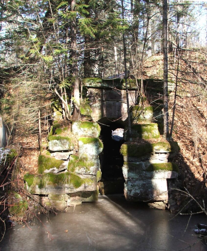
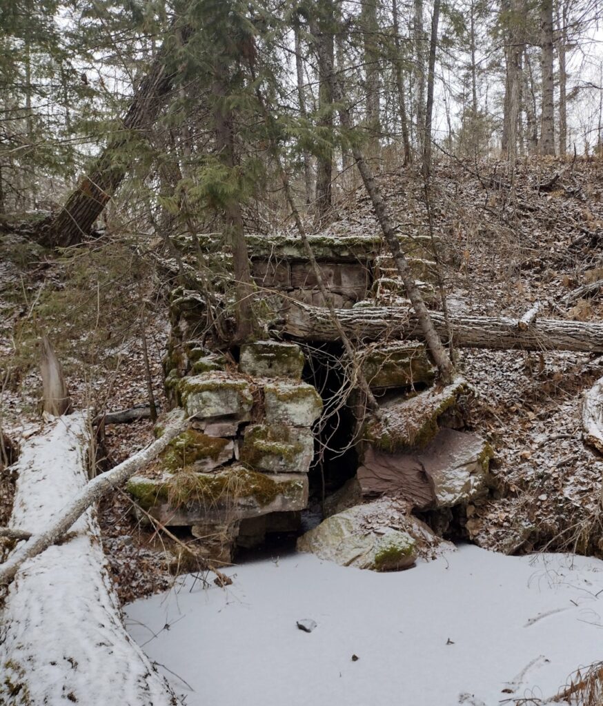
The culvert
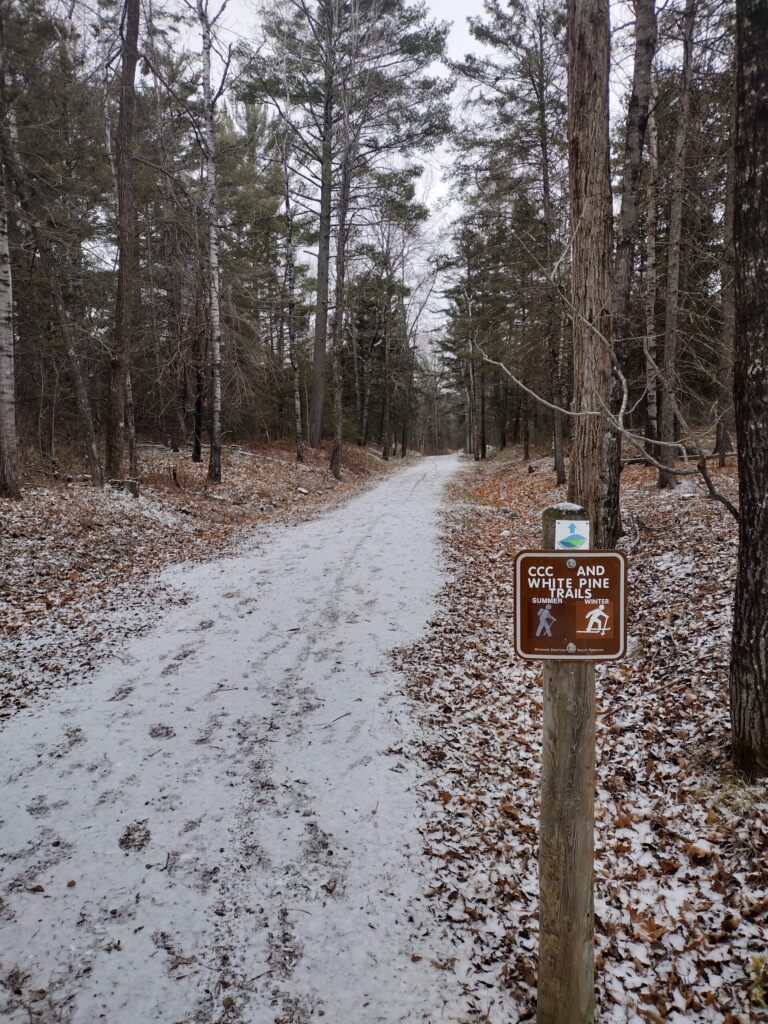
One of the most interesting and easily accessible historical features of the Skally Line is the remains of an old sandstone-block culvert—likely from the original 1870 construction. Water still drains through this culvert today. Go and see it while you can.
Leave your car at park headquarters and cross Highway 210 to the White Pine Trail. Follow the trail east a quarter mile or so, until you encounter a big dip in the trail. This is where you will find the culvert.
The top of the culvert is visible from the trail, but if you want an even better view, you can climb down.
Between 2019 (the last time I visited) and 2023, a tree fell on the culvert, knocking several blocks loose and buckling one side. When the culvert fails completely, it seems likely that the park will install a modern replacement.
Cover photo: Culvert detail. Credit: John Ramos
Update, Nov. 30, 2023. Added information that Jay Cooke was the original owner of the Skally Line.
Correction, Dec. 2, 2023. Article originally stated that the Skally Line closed in 1897. It actually closed in 1894.
Correction, Feb. 2, 2024. The Monitor has learned that the Lake Superior & Mississippi Railroad was not nicknamed the “Skally Line” until about 1888. It would not have been known as such in 1870.


Another great piece, John, on the history of Duluth. Your other two pieces should be linked here because they’re also well done.
Another little-known historical possible fact is that Native Americans made up the bulk of the labor to build the railroad line through the Jay Cooke area. I found this out while attending a MNDOT historical research meeting when they were trying to decide when and how to rebuild Highway 210 after the 2012 flood.
The current Lake Superior & Mississippi Railroad is helping to keep some of the history alive by maintaining the last segment of the route into Duluth. They adopted a new tagline called “Duluth River Train” to differentiate themselves from the North Shore Scenic Railroad.
https://duluthrivertrain.com/